¶ Radar vectoring
¶ Introduction
Radar vectoring is a technique allowing the controller to manipulate an aircraft's flight path by giving it a magnetic heading to follow. Navigation of the aircraft therefore becomes the controller's responsibility. It will therefore be understood that an aircraft under vectoring requires significantly more resources from the radar controller than an aircraft following a procedure.
¶ Objectives of radar vectoring
¶ Creating separation
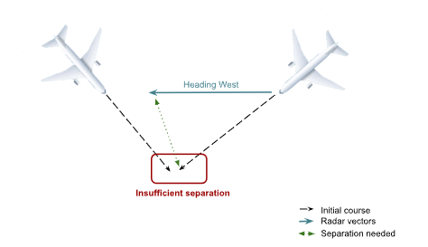
Vectoring makes it possible to create and/or increase lateral separation between two aircraft operating in proximity.
Vectoring can therefore allow the controller to alter a traffic's flight path in order to avoid certain conflicts
¶ Weather avoidance
Near a storm cell, it sometimes happens that a pilot requests a heading / direction to take in order to avoid the weather.
In this case, the controller can only approve and regularly monitor how the action unfolds.
¶ Sequencing
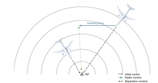
Radar vectoring also makes it possible to "slow down" or "speed up" a traffic by changing its flight path in order to integrate it into the approach sequence. Of course, a change of flight path has very little effect on the (strictly speaking) speed of the aircraft.
Only, by lengthening its flight path between a point A and a point B, it will take longer to reach these points.
Similarly, by shortening the aircraft's flight path between A and B, it gains time. This is one of the fundamental principles of sequencing, and it is only achievable thanks to vectoring.
¶ Optimization
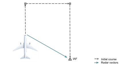
In a context of low traffic levels, vectoring can help optimize the arrival of aircraft by allowing them a more direct approach that would not be possible during peak hours. This is a maneuver that benefits everyone: crew, controller, environment.
¶ How to vector an aircraft?
¶ The method
Radar vectoring therefore consists of a magnetic heading given to the pilot in increments of 5°.
Example: Heading 110°, 185°,...) toward which the pilot will have to turn the aircraft.
Taking the aircraft off its initial flight path must be planned. Moreover, taking an aircraft off its predefined route must be accompanied by a reason in order to make our view of the situation clear to the pilot.
The various reasons for vectoring can be:
- Due to conflict
- Due to traffic
- For separation
- For sequencing
- For approach
¶ Factors to take into consideration
¶ Wind
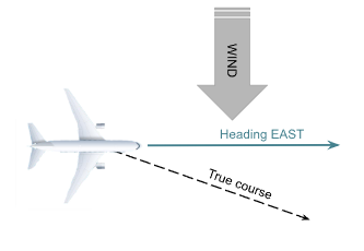
As indicated previously, the pilot must orient their aircraft toward the heading given to them, however wind can create a discrepancy between the aircraft's heading and its actual track. It is therefore important to know the direction and strength of the wind in your control zone before being able to give a radar vector.
Example: In the case below, it would be preferable to give the pilot a heading slightly further north (080°, 070°,...) so that its actual track is a track toward the east.
¶ The latency between clearance and action
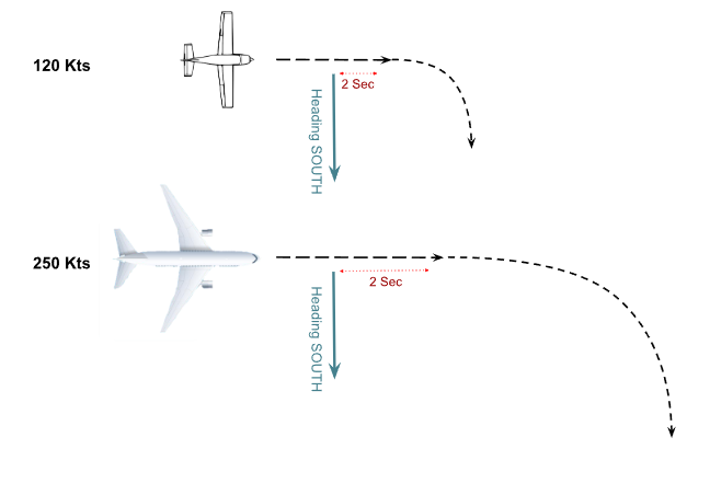
Vectoring makes it possible to place aircraft where desired, in a fairly precise manner. However, the controller must anticipate several factors to ensure the turn is carried out in time:
- The time it takes pilots to execute the clearance (approximately 5 sec);
- The aircraft's speed (the faster it goes, the larger the turn radius);
- The aircraft's category (a Cessna Citation can turn more easily than a Boeing 747).
All these factors add time to the crew's execution of the controller's instruction, so the controller must anticipate their clearance.
Examples :
¶ Terrain and restrictions
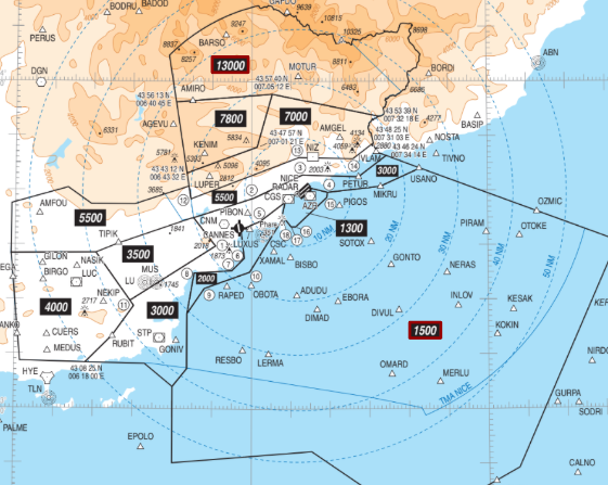
Published procedures (SIDs, STARs, Transitions, Approaches,...) are designed to protect the aircraft from terrain. However, to maintain this safety during radar vectoring, there are Minimum Radar Vectoring Altitudes. They are indicated by geographic zone, and it is impossible to vector an aircraft below these altitudes.
Example:
Example from Nice:
Similarly, your vectoring must never lead the aircraft into a zone it is not authorized to enter.
Example:
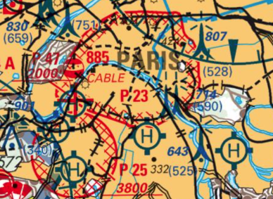
Example of Paris's P23: